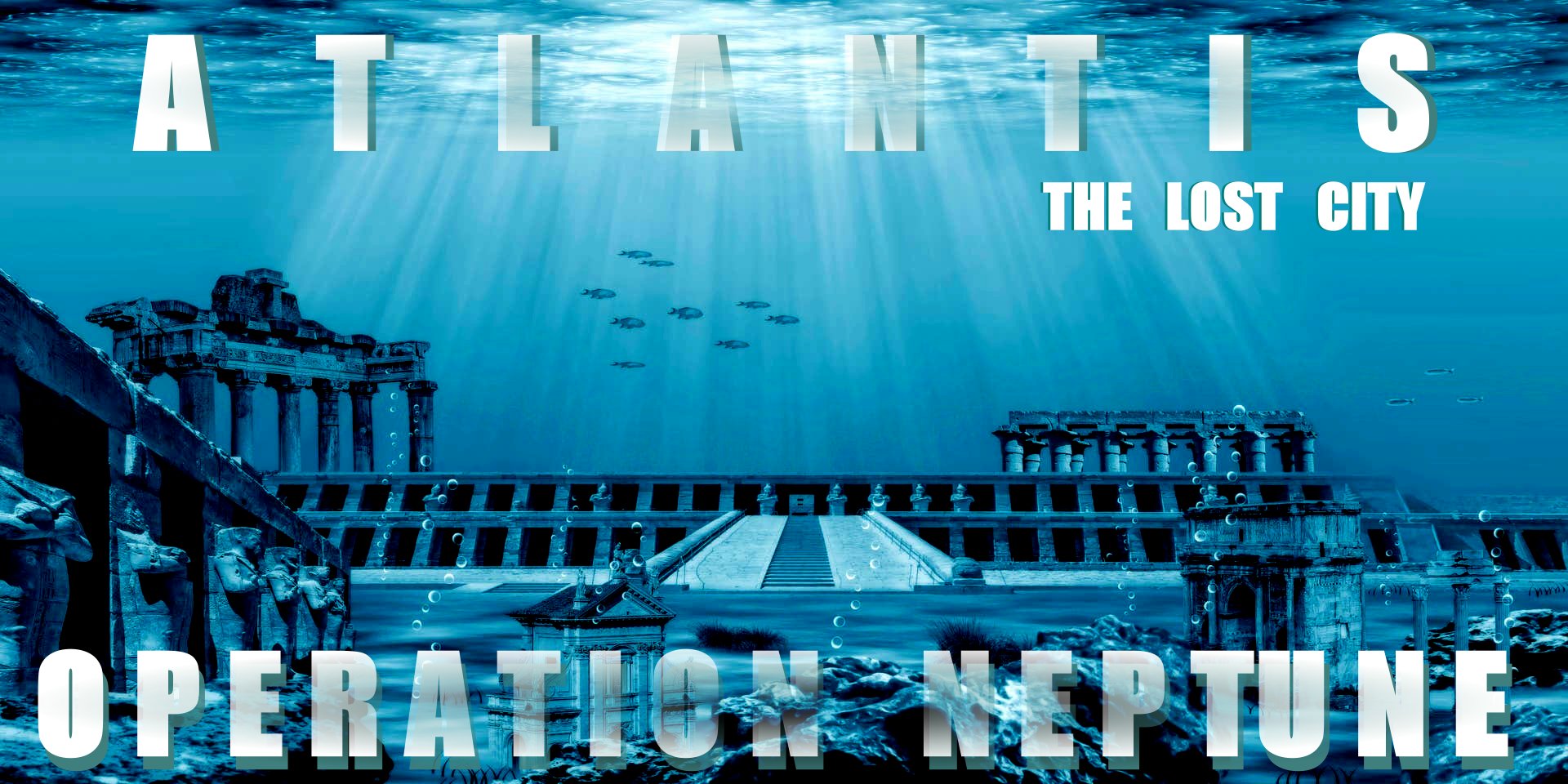
|
PLATO
- OF
ATHENS, GREEK PHILOSPHER
The Athenian philosopher
Plato (427- 437
BC), stated that the people of Atlantis lived peacefully on a prosperous island beyond the
Pillars of Hercules (today's narrow passages of Gibraltar), so it is assumed that Atlantis was probably located somewhere between Europe and America,
in the Atlantic Ocean. Taking that on good faith, and knowing that volcanic
eruptions and earthquakes, cause
tsunamis, and tsunamis are known to have sunk a number of cities, namely Alexandria
further south in the Mediterranean
Sea, and Port
Royal in the Caribbean
Sea. Taking
these documented examples onboard, it is possible that an island that the
Athenians and Plato could have had knowledge of, may have been sunk.
The story of Atlantis was conveyed to Solon by Ancient
Egyptian priests on one of his trips to
Egypt, as says
Plato. Plato describes the story of Atlantis in his dialogues Critias and
Timaeus. Thus he is either to blame for perpetuating a myth, but since he was
not prone to imaginings, we might take his writings on good faith - subject to
interpretation - and that is the rub.
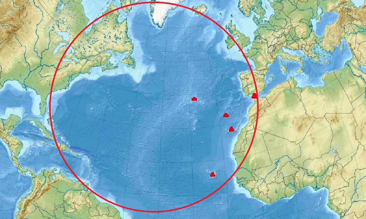
NORTH
ATLANTIC OCEAN - Trying to understand Plato's point of view, and his
description: "Beyond the Pillars of Hercules." We might try to look
at scale. He did not say far, far across the ocean. Nor did he mention the Bay
of Biscay or English Channel. Thus, logically, we might dismiss notions of
Iceland and Ireland, and any land mass further than the length of the
Mediterranean Sea, east to west. That leaves us with the red triangles shown
in the perimeter circle above,
if we assume there may have been geological disturbances at these locations.
Alternatively, Atlantis, may have sunk without trace. But at least we have a
(most) likely area to consider.
That
is until we look again at Plato’s texts: Atlantis was “larger than Libya and Asia combined,” (which, in Plato’s time, would have referred to modern-day northern Africa and over half of Turkey). It was situated in
(not across, or over) the Atlantic Ocean, somewhere outward from the Strait of Gibraltar. It’s a landmass large enough that, if it
existed somewhere underwater in the Atlantic, it would almost certainly appear on sonar maps of the ocean floor.
Or, the size estimate (as it was relayed several times) may have been exaggerated.
The term "Atlanteans" was also applied by the Greeks to the Phoenician colonies along the Barbary Coast of North
Africa - i.e. those living near the Atlas Mountains. Diodorus Siculus describes their Titan-mythology and wars with the Libyan Amazones. Plato may have the same nation in mind for he names the second Atlantean king Gadeiros after a famous Phoenician colony near the Straits of Gibraltar.
PLATO'S ATLANTIS
briefing on Plato’s original tale, its geographical clues, and survey methods marine archaeologists can adapt when chasing “Atlantis” off Morocco.
1. Plato’s Two Dialogues • Source texts: Timaeus and Critias (c. 360 BCE), framed as Socratic dialogues at the Panathenaea festival. • Key elements: – Island “larger than Libya and Asia” with concentric rings of sea and land, linked by canals and bridges. – Capital crowned by a Poseidon‐built temple around a central hill. – A powerful, seafaring state that grew arrogant; divine retribution came as “violent earthquakes and floods,” submerging the island in a single day and night of misfortune2.
2. Chronology & Origin Story • Solon’s Egyptian informants (c. 600 BCE) claimed Atlantis fell ~9 000 years before their time—placing its demise around 9 600 BCE. • Platonists see this as a mythic back‐date to lend gravitas; for fiction, however, that deep‐time anchor suggests pre‐Holocene sea‐level datasets are crucial.
3. “Beyond the Pillars of Hercules” • Plato locates Atlantis “in front of the strait you call the Pillars of Hercules”—traditionally the Strait of Gibraltar. • Yet ancient Greeks sometimes applied “Pillars of Hercules” to other geographical limits (e.g., the Black Sea entrance), making it a flexible boundary marker rather than a fixed point4.
4. Cataclysmic Analogues & Sedimentary Clues Real‐world parallels: – Alexandria’s damage in the 365 CE Crete earthquake/tsunami. – Port Royal’s destruction by the 1692 Jamaica quake and surge.
For a Moroccan “Atlantis,” look for: • Tsunami‐deposit layers in coastal cores (anomalous sand beds, marine microfossils). • Submerged paleoshorelines dated via OSL or radiocarbon. • Seismic fault traces offshore that could have collapsed a platform.
5. Marine‐Archaeology Toolkit • Multibeam echosounders & sub‐bottom profilers to detect buried ring‐shaped or orthogonal features. • Side‐scan sonar & DIDSON acoustic imaging (e.g., Dunwich “Britain’s Atlantis” used DIDSON to map submerged medieval streets). • Magnetometer surveys for stonework anomalies. • Sediment coring to pinpoint high‐energy event layers. • 3D photogrammetry/ROV imaging for detailed mapping of ruins. • Paleoenvironmental reconstruction (macrofauna, diatoms) to confirm rapid inundation.
Beyond Plato’s narrative, no contemporaneous classical author adds fresh island names or coordinates—so these geological and geophysical approaches will be your best pathfinder for a real lost city off Morocco’s coast.
“But afterwards there occurred violent earthquakes and floods; and in a single day and night of misfortune all your warlike men in a body sank into the earth, and the island of Atlantis in like manner disappeared in the depths of the sea.”
WHO WAS PLATO?
Plato (c. 428/427 BCE–348/347 BCE) was born into an aristocratic family in Athens, Greece, the son of Ariston and Perictione. Through his mother he was descended from the lawgiver Solon. Although he spent most of his life in Athens, he also traveled to Sicily and, by some accounts, to
Egypt in pursuit of philosophical and political inquiry 2.
A devoted student of Socrates, Plato witnessed his teacher’s trial and execution, an experience that profoundly shaped his thought. Around 387 BCE he founded the Academy just outside Athens—the first institution of higher learning in the Western world. Over the next five decades he authored some thirty-five dialogues and letters, including The Republic, Symposium, Phaedo and Timaeus. Through these works he developed his theory of Forms (or Ideas), articulated the Allegory of the Cave, and laid foundations for epistemology, metaphysics, ethics and political philosophy. Among his most famous students was Aristotle, who carried forward and transformed many Platonic themes 3.
Historically, Plato’s impact cannot be overstated: his Academy survived as a centre of learning until its suppression in 529 CE, and his writings have been studied continuously for some 2,400 years. His conception of abstract universals, his model of the ideal state, and his dialectical method have shaped virtually every major strand of Western philosophy, theology and political theory—from Neoplatonism and early Christian thought to modern analytic and continental traditions.
https://www.britannica.com/biography/Plato
https://www.notablebiographies.com/Pe-Pu/Plato.html
https://en.wikipedia.org/wiki/Plato
https://www.britannica.com/biography/Plato
https://www.notablebiographies.com/Pe-Pu/Plato.html
https://en.wikipedia.org/wiki/Plato
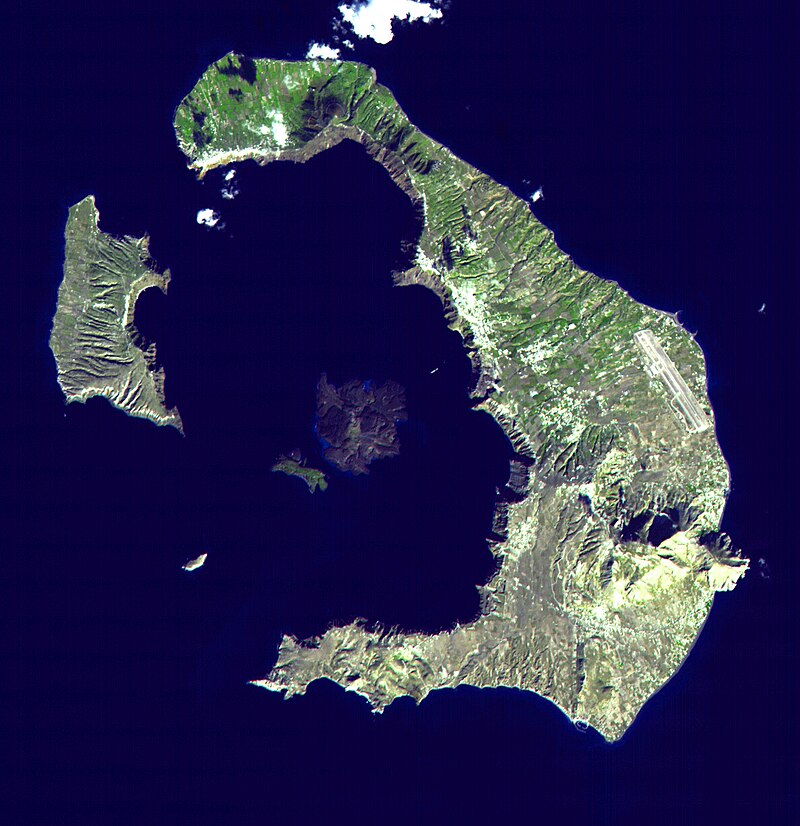
MALTA
& SANTORINI
(THERA) - Are two geographical locations we might reasonably dismiss in the
quest for Atlantis, if Plato is to be believed, since they are not beyond the
Pillars of Hercules. Though they are islands suffering geological
disturbances. The Americas could not have been
held to be islands, and possibly not even know of. Leaving us with Angra do Heroismo, Ponnta Delgada, Funchal, and
the Canary Islands. The archipelago's seven main islands are (from largest to smallest in area) Tenerife, Fuerteventura, Gran Canaria, Lanzarote, La Palma, La Gomera, and El
Hierro. And then further south, Cabo Verde.
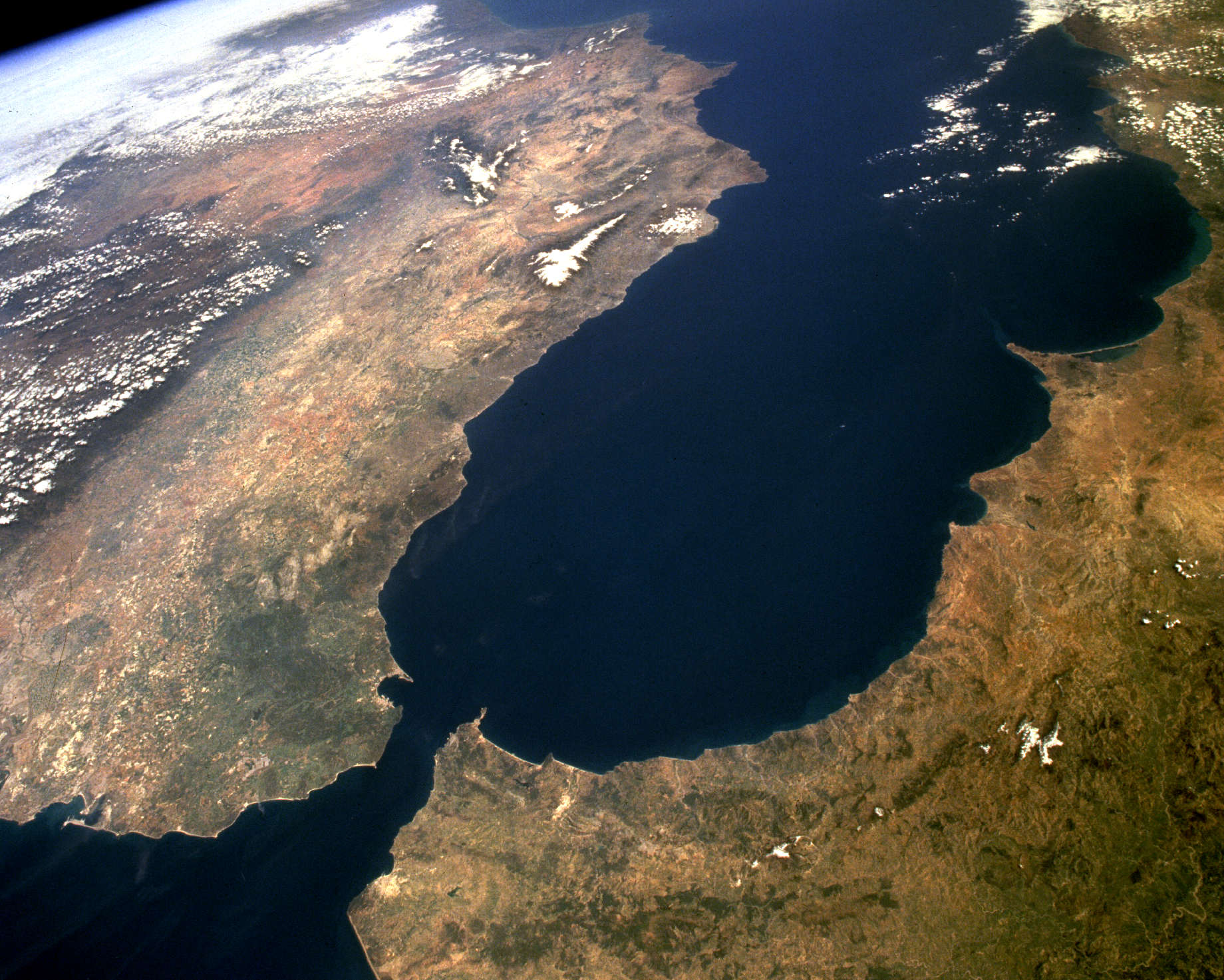
STRAITS OF GIBRALTAR
The Strait is an important shipping route from the Mediterranean to the Atlantic. There are ferries that operate between Spain and Morocco across the Strait, as well as between Spain and Ceuta and Gibraltar to Tangier.
The Strait of Gibraltar (Arabic: مضيق جبل طارق, romanized: Maḍīq Jabal Ṭāriq; Spanish: Estrecho de Gibraltar, Archaic: Pillars of Hercules), also known as the Straits of Gibraltar, is a narrow strait that connects the Atlantic Ocean to the Mediterranean Sea and separates the Iberian Peninsula in Europe from Morocco in Africa.
The two continents are separated by 13 kilometres (8.1 miles; 7.0 nautical miles) of ocean at the Strait's narrowest point between Point Marroquí in Spain and Point Cires in Morocco. Ferries cross between the two continents every day in as little as 35 minutes. The Strait's depth ranges between 300 and 900 metres (980 and 2,950 feet; 160 and 490 fathoms) which possibly interacted with the lower mean sea level of the last major glaciation 20,000 years ago when the level of the sea is believed to have been lower by 110–120 m (360–390 ft; 60–66 fathoms).
The strait lies in the territorial waters of Morocco, Spain, and the British overseas territory of Gibraltar. Under the United Nations Convention on the Law of the Sea, foreign vessels and aircraft have the freedom of navigation and overflight to cross the strait of Gibraltar in case of continuous transit.
The name comes from the Rock of Gibraltar, which in turn originates from the Arabic Jabal Ṭāriq (meaning "Tariq's Mount"), named after Tariq ibn Ziyad. It is also known as the Straits of Gibraltar, the Gut of Gibraltar (although this is mostly archaic), the STROG (STRait Of Gibraltar) in naval use.
Another Arabic name is Bāb al-maghrib (Arabic: باب المغرب), meaning "Gate of the West" or "Gate of the sunset", and furthermore "Gate of the Maghreb" or "Gate of Morocco". In the Middle Ages it was called in Arabic Az-Zuqāq (الزقاق), "the Passage" and by the Romans Fretum Gaditanum (Strait of Cadiz).
In Latin it has been called Fretum Herculeum, based on the name from antiquity "Pillars of Hercules" (Ancient Greek: αἱ Ἡράκλειοι στῆλαι, romanized: hai Hērákleioi stêlai), referring to the mountains as pillars, such as Gibraltar, flanking the strait.
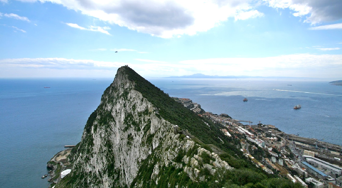
THE
ROCK - View across the Strait of Gibraltar, to Jebel Musa in the background.
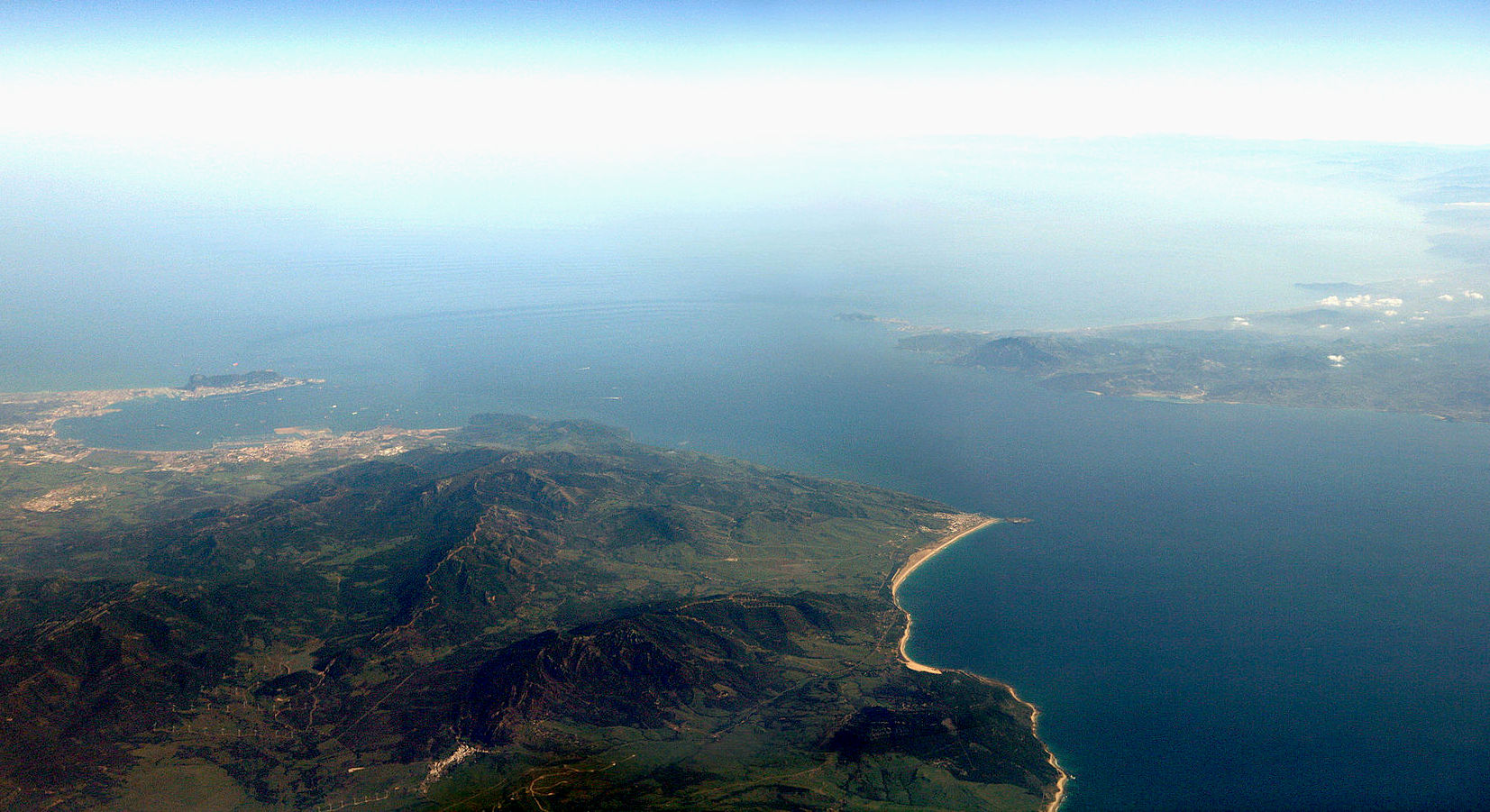
Aerial
view of the Strait of Gibraltar, where you can envisage the Pillars of
Hercules as the two outcrops distinct from the land masses of Spain and
Morocco.
HISTORY
Evidence of the first human habitation of the area by Neanderthals dates back to 125,000 years ago. It is believed that the Rock of Gibraltar may have been one of the last outposts of Neanderthal habitation in the world, with evidence of their presence there dating to as recently as 24,000 years ago. Archaeological evidence of
Homo sapiens habitation of the area dates back c. 40,000 years.
The relatively short distance between the two shores has served as a quick crossing point for various groups and civilizations throughout history, including Carthaginians campaigning against Rome, Romans travelling between the provinces of Hispania and Mauritania, Vandals raiding south from Germania through Western Rome and into North Africa in the 5th century, Moors and Berbers in the 8th–11th centuries, and Spain and Portugal in the 16th century.
Beginning in 1492, the Strait began to play a certain cultural role in acting as a barrier against cross-channel conquest and the flow of culture and language that would naturally follow such a conquest. In that year, the last Muslim government north of the Strait was overthrown by a Spanish force. Since that time, the Strait has come to foster the development of two very distinct and varied cultures on either side of it after sharing much the same culture for over 500 years from the 8th century to the early 13th century.
On the northern side, Christian-European culture has remained dominant since the expulsion of the last Muslim kingdom in 1492, along with the Romance Spanish language, while on the southern side, Muslim-Arabic/Mediterranean has been dominant since the spread of Islam into North Africa in the 700s, along with the Arabic language. For the last 500 years, religious and cultural intolerance, more than the small travel barrier that the Strait presents, has come to act as a powerful enforcing agent of the cultural separation that exists between these two groups.
The small British enclave of the city of Gibraltar presents a third cultural group found in the Strait. This enclave was first established in 1704 and has since been used by Britain to act as a surety for control of the sea lanes into and out of the Mediterranean.
Following the Spanish coup of July 1936 the Spanish Republican Navy tried to blockade the Strait of Gibraltar to hamper the transport of Army of Africa troops from Spanish Morocco to Peninsular Spain. On 5 August 1936 the so-called Convoy de la victoria was able to bring at least 2,500 men across the Strait, breaking the republican blockade.
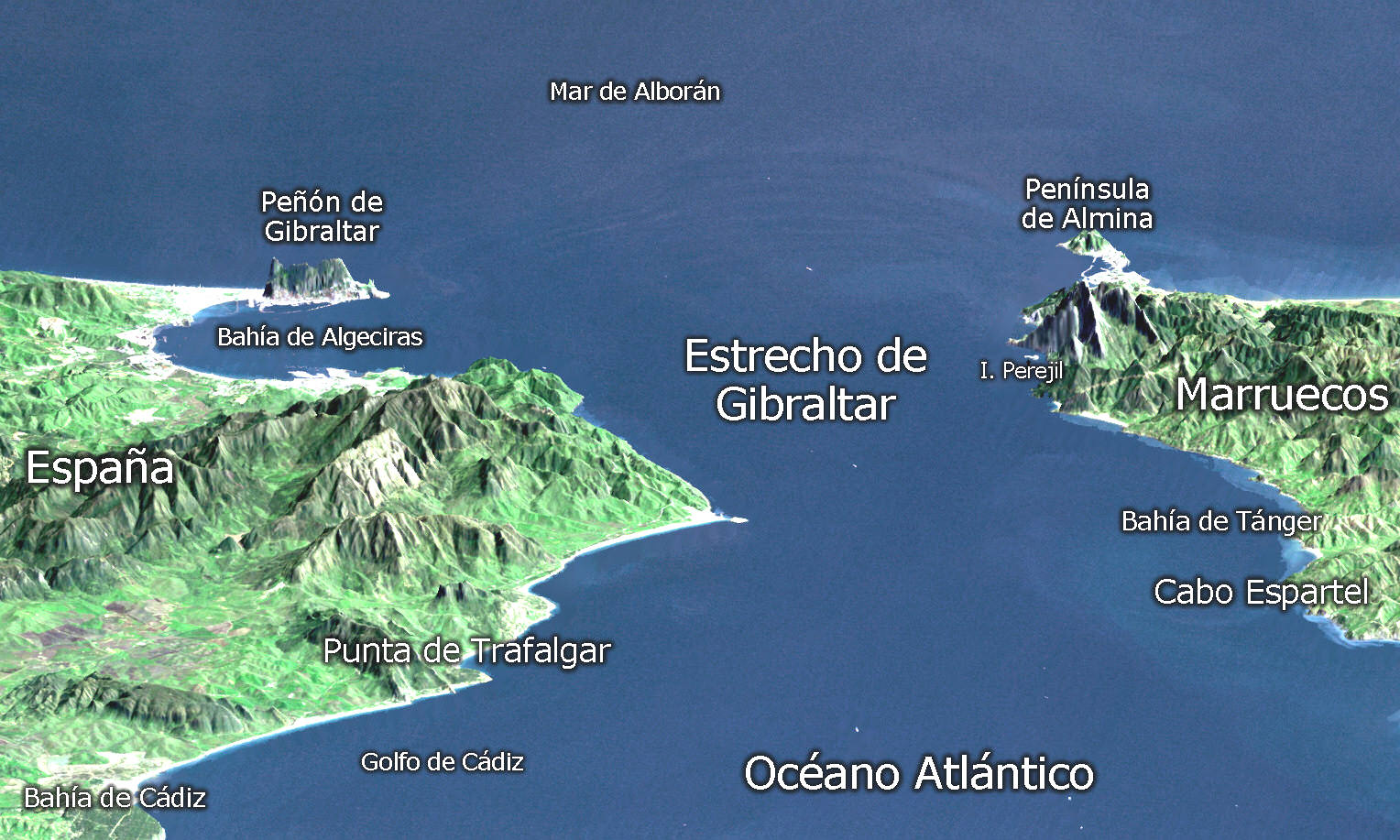
3D
relief of Estrecho de Gibraltar - Pillars of Hercules
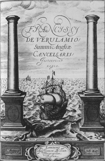
Francis Bacon: Instauratio Magna 1620
SPARTEL
Spartel Bank or Majuán Bank is a submerged former island located in the Strait of Gibraltar near Cape Spartel and the Spartel Sill. Its highest point is currently 56 metres (184 ft) below the surface. Spartel Bank is one of several seamounts in the bed of Gibraltar Strait; similar but deeper seamounts are found at Camarinal Sill and further east. These represent landslide blocks which slid south from the north bank of the Strait of Gibraltar when the strait was formed, possibly through erosion by inflowing waters of the Zanclean flood.
It vanished under the surface approximately 12,000 years ago due to rising ocean levels from melting ice caps after the last Glacial Maximum. It has been proposed by researchers Jacques Collina-Girard and Marc-André Gutscher as a site for the legendary lost island of Atlantis. In follow-up correspondence, however, Gutscher indicated that the island could not have been Atlantis, referring to Plato's description of a Bronze Age society, which Spartel could not have supported at the time. A detailed review in the Bryn Mawr Classical Review comments on the discrepancies in Collina-Girard's dates and use of coincidences, concluding that he "has certainly succeeded in throwing some light upon some momentous developments in human prehistory in the area west of Gibraltar. Just as certainly, however, he has not found Plato's Atlantis."
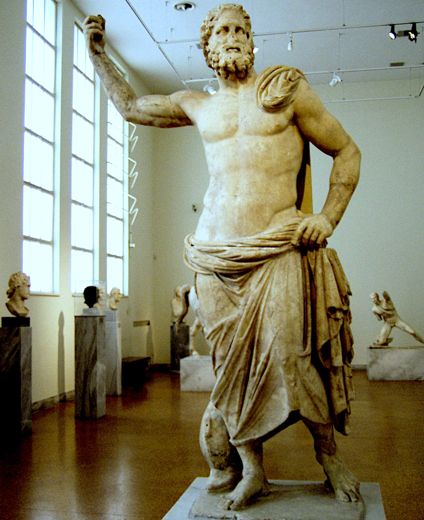
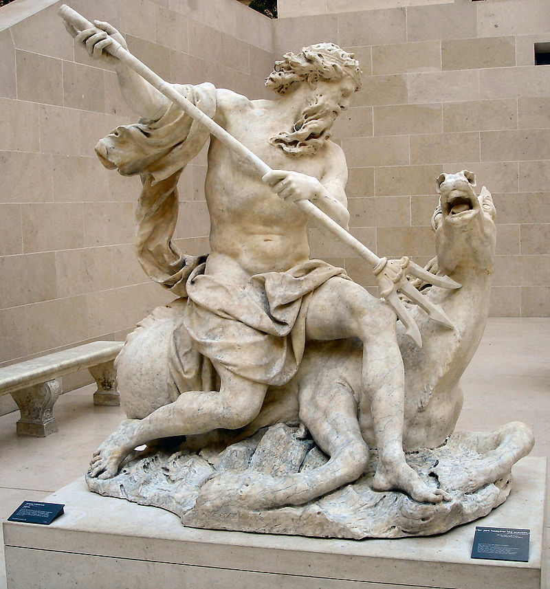
POSEIDON
AND NEPTUNE
|