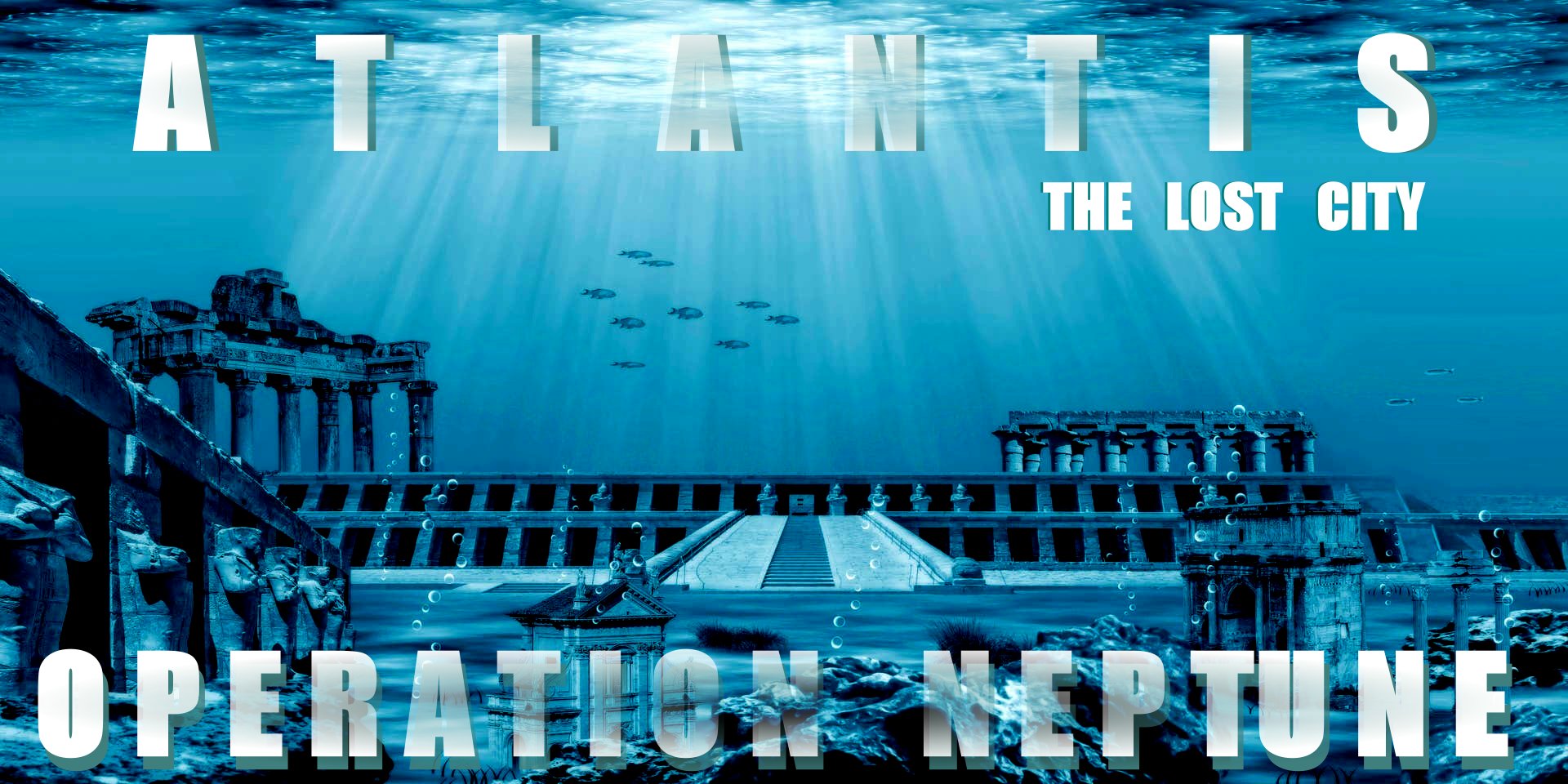
|
PILLARS
OF HERCULES
- STRAITS
OF GIBRALTAR
The Athenian philosopher Plato (427- 437
BC), stated that the people of Atlantis lived peacefully on a prosperous island beyond the Pillars of Hercules (today's narrow passages of Gibraltar), so it is assumed that Atlantis was probably located somewhere between Europe and America,
in the Atlantic Ocean. Taking that on good faith, and knowing that volcanic
eruptions and earthquakes, cause
tsunamis, and tsunamis are known to have sunk a number of cities, namely Alexandria
further south in the Mediterranean
Sea, and Port
Royal in the Caribbean
Sea. Taking
these documented examples onboard, it is possible that an island that the
Athenians and Plato could have had knowledge of, may have been sunk.
The story of Atlantis was conveyed to Solon by Ancient
Egyptian priests on one of his trips to
Egypt, as says
Plato. Plato describes the story of Atlantis in his dialogues Critias and
Timaeus. Thus he is either to blame for perpetuating a myth, but since he was
not prone to imaginings, we might take his writings on good faith - subject to
interpretation - and that is the rub.
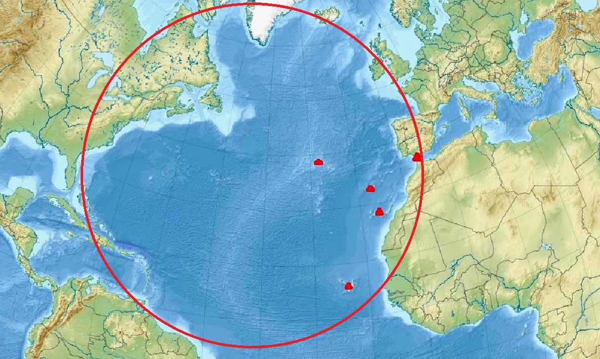
NORTH
ATLANTIC OCEAN - Trying to understand Plato's point of view, and his
description: "Beyond the Pillars of Hercules." We might try to look
at scale. He did not say far, far across the ocean. Nor did he mention the Bay
of Biscay or English Channel. Thus, logically, we might dismiss notions of
Iceland and Ireland, and any land mass further than the length of the
Mediterranean Sea, east to west. That leaves us with the red triangles shown
in the perimeter circle above,
if we assume there may have been geological disturbances at these locations.
Alternatively, Atlantis, may have sunk without trace. But at least we have a
(most) likely area to consider.
That
is until we look again at Plato’s texts: Atlantis was “larger than Libya and Asia combined,” (which, in Plato’s time, would have referred to modern-day northern Africa and over half of Turkey). It was situated in
(not across, or over) the Atlantic Ocean, somewhere outward from the Strait of Gibraltar. It’s a landmass large enough that, if it
existed somewhere underwater in the Atlantic, it would almost certainly appear on sonar maps of the ocean floor.
Or, the size estimate (as it was relayed several times) may have been exaggerated.
The term "Atlanteans" was also applied by the Greeks to the Phoenician colonies along the Barbary Coast of North
Africa - i.e. those living near the Atlas Mountains. Diodorus Siculus describes their Titan-mythology and wars with the Libyan Amazones. Plato may have the same nation in mind for he names the second Atlantean king Gadeiros after a famous Phoenician colony near the Straits of Gibraltar.
The Pillars of Hercules (Latin: Columnae Herculis, Ancient Greek: Ἡράκλειαι Στῆλαι, romanized: Hērákleiai Stêlai, Arabic: أعمدة هرقل, romanized: Aʿmidat Hiraql, Spanish: Columnas de Hércules) was the phrase that was applied in Antiquity to the promontories that flank the entrance to the Strait of Gibraltar. The northern Pillar, Calpe Mons, is the Rock of Gibraltar. A corresponding North African peak not being predominant, the identity of the southern Pillar, Abila Mons, has been disputed throughout history, with the two most likely candidates being Monte Hacho in Ceuta and Jebel Musa in Morocco.
According to Greek mythology adopted by the Etruscans and Romans, when Hercules had to perform twelve labours, one of them (the tenth) was to fetch the Cattle of Geryon of the far West and bring them to Eurystheus; this marked the westward extent of his travels. A lost passage of Pindar quoted by Strabo was the earliest traceable reference in this context: "the pillars which Pindar calls the 'gates of Gades' when he asserts that they are the farthermost limits reached by Heracles". Since there has been a one-to-one association between Heracles and Melqart since Herodotus, the "Pillars of Melqart" in the temple near Gades/Gádeira (modern Cádiz) have sometimes been considered to be the true Pillars of Hercules.
Plato placed the fictional island of Atlantis beyond the "Pillars of Hercules". Renaissance tradition says the pillars bore the warning Ne plus ultra (also Non plus ultra, "nothing further beyond"), serving as a warning to sailors and navigators to go no further.
According to some Roman sources, while on his way to the garden of the Hesperides on the island of Erytheia, Hercules had to cross the mountain that was once Atlas. Instead of climbing the great mountain, Hercules used his superhuman strength to smash through it. By doing so, he connected the
Atlantic Ocean to the
Mediterranean Sea and formed the Strait of Gibraltar. One part of the split mountain is Gibraltar and the other is either Monte Hacho or Jebel Musa. These two mountains taken together have since then been known as the Pillars of Hercules, though other natural features have been associated with the name.
Diodorus Siculus, however, held that, instead of smashing through an isthmus to create the Straits of Gibraltar, Hercules "narrowed" an already existing strait to prevent monsters from the Atlantic Ocean from entering the Mediterranean Sea.
In some versions, Heracles instead built the two to hold the sky away from the earth, liberating Atlas from his damnation.
PHOENICIAN CONNECTION
Beyond Gades, several important Mauretanian colonies (in modern-day Morocco) were founded by the Phoenicians as the Phoenician merchant fleet pushed through the Pillars of Hercules and began constructing a series of bases along the Atlantic coast starting with Lixus in the north, then Chellah and finally Mogador.
Near the eastern shore of the island of Gades/Gadeira (modern Cádiz, just beyond the strait) Strabo describes the westernmost temple of Tyrian Heracles, the god with whom Greeks associated the Phoenician and Punic Melqart, by interpretatio graeca. Strabo notes that the two bronze pillars within the temple, each eight cubits high, were widely proclaimed to be the true Pillars of Hercules by many who had visited the place and had sacrificed to Heracles there. But Strabo believes the account to be fraudulent, in part noting that the inscriptions on those pillars mentioned nothing about Heracles, speaking only of the expenses incurred by the Phoenicians in their making. The columns of the Melqart temple at Tyre were also of religious significance.
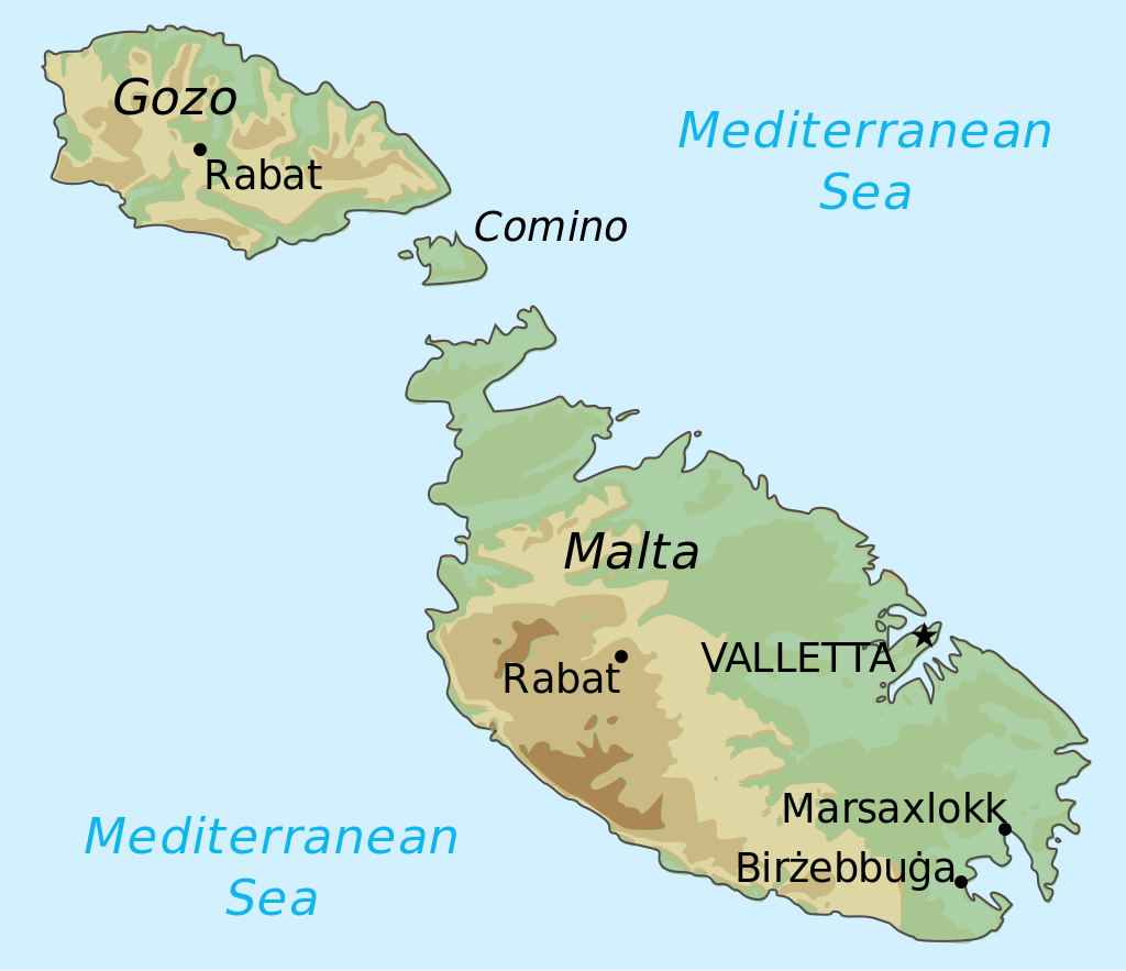
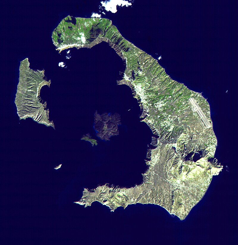
MALTA
& SANTORINI
(THERA) - Are two geographical locations we might reasonably dismiss in the
quest for Atlantis, if Plato is to be believed, since they are not beyond the
Pillars of Hercules. Though they are islands suffering geological
disturbances. The Americas could not have been
held to be islands, and possibly not even know of. Leaving us with Angra do Heroismo, Ponnta Delgada, Funchal, and
the Canary Islands. The archipelago's seven main islands are (from largest to smallest in area) Tenerife, Fuerteventura, Gran Canaria, Lanzarote, La Palma, La Gomera, and El
Hierro. And then further south, Cabo Verde.
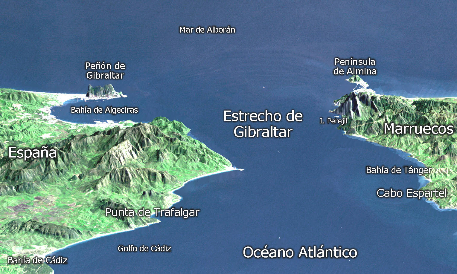
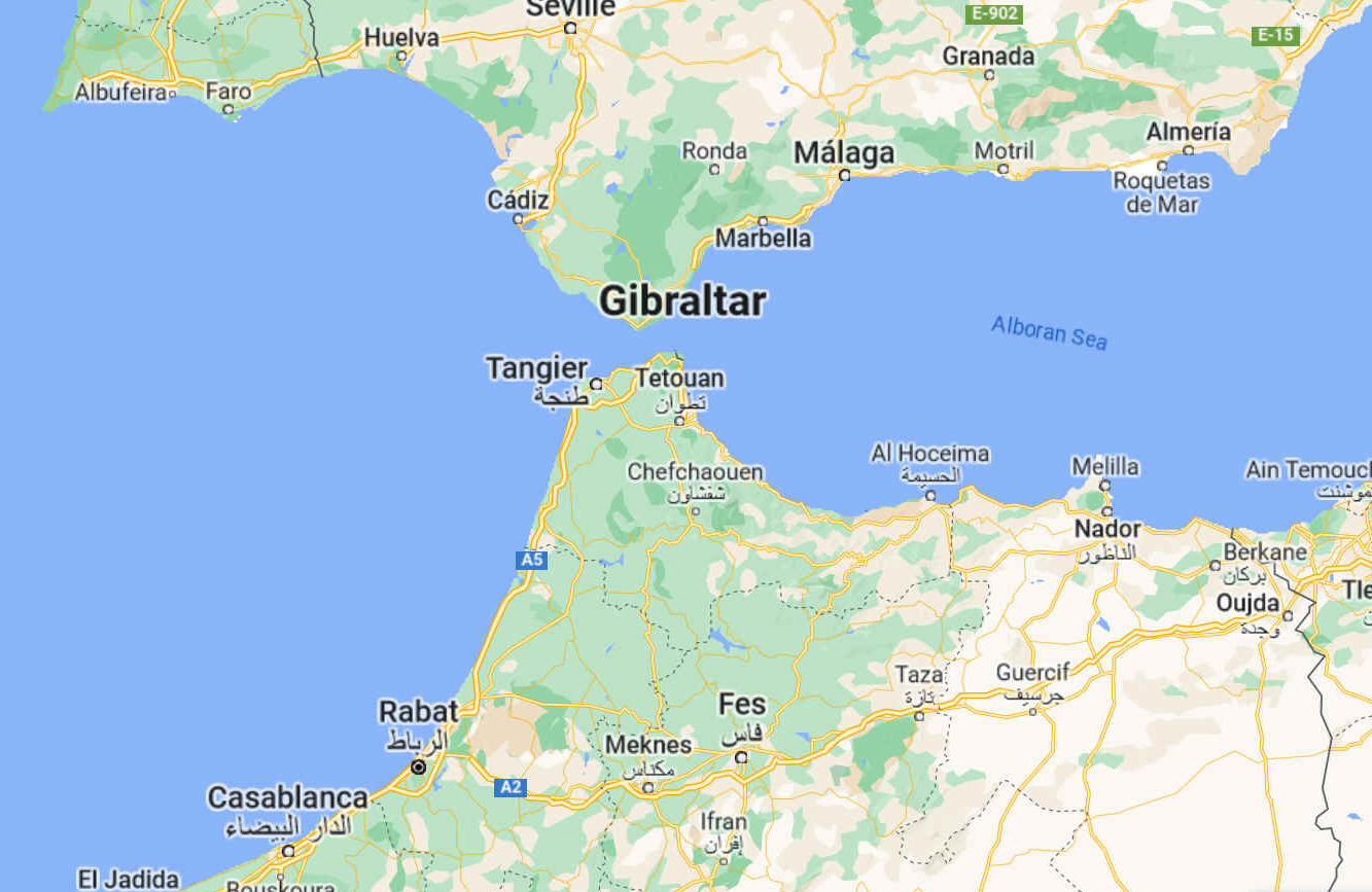
STRAITS OF GIBRALTAR
The Strait is an important shipping route from the Mediterranean to the Atlantic. There are ferries that operate between Spain and Morocco across the Strait, as well as between Spain and Ceuta and Gibraltar to Tangier.
The Strait of Gibraltar (Arabic: مضيق جبل طارق, romanized: Maḍīq Jabal Ṭāriq; Spanish: Estrecho de Gibraltar, Archaic: Pillars of Hercules), also known as the Straits of Gibraltar, is a narrow strait that connects the Atlantic Ocean to the Mediterranean Sea and separates the Iberian Peninsula in Europe from Morocco in Africa.
The two continents are separated by 13 kilometres (8.1 miles; 7.0 nautical miles) of ocean at the Strait's narrowest point between Point Marroquí in Spain and Point Cires in Morocco. Ferries cross between the two continents every day in as little as 35 minutes. The Strait's depth ranges between 300 and 900 metres (980 and 2,950 feet; 160 and 490 fathoms) which possibly interacted with the lower mean sea level of the last major glaciation 20,000 years ago when the level of the sea is believed to have been lower by 110–120 m (360–390 ft; 60–66 fathoms).
The strait lies in the territorial waters of Morocco, Spain, and the British overseas territory of Gibraltar. Under the United Nations Convention on the Law of the Sea, foreign vessels and aircraft have the freedom of navigation and overflight to cross the strait of Gibraltar in case of continuous transit.
The name comes from the Rock of Gibraltar, which in turn originates from the Arabic Jabal Ṭāriq (meaning "Tariq's Mount"), named after Tariq ibn Ziyad. It is also known as the Straits of Gibraltar, the Gut of Gibraltar (although this is mostly archaic), the STROG (STRait Of Gibraltar) in naval use.
Another Arabic name is Bāb al-maghrib (Arabic: باب المغرب), meaning "Gate of the West" or "Gate of the sunset", and furthermore "Gate of the Maghreb" or "Gate of Morocco". In the Middle Ages it was called in Arabic Az-Zuqāq (الزقاق), "the Passage" and by the Romans Fretum Gaditanum (Strait of Cadiz).
In Latin it has been called Fretum Herculeum, based on the name from antiquity "Pillars of Hercules" (Ancient Greek: αἱ Ἡράκλειοι στῆλαι, romanized: hai Hērákleioi stêlai), referring to the mountains as pillars, such as Gibraltar, flanking the strait.
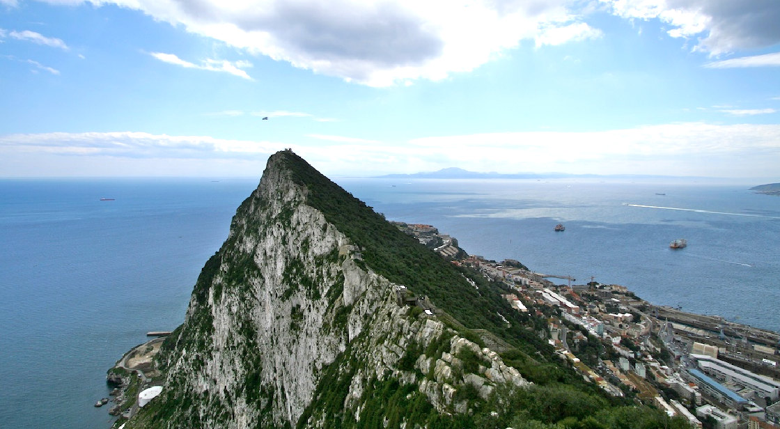
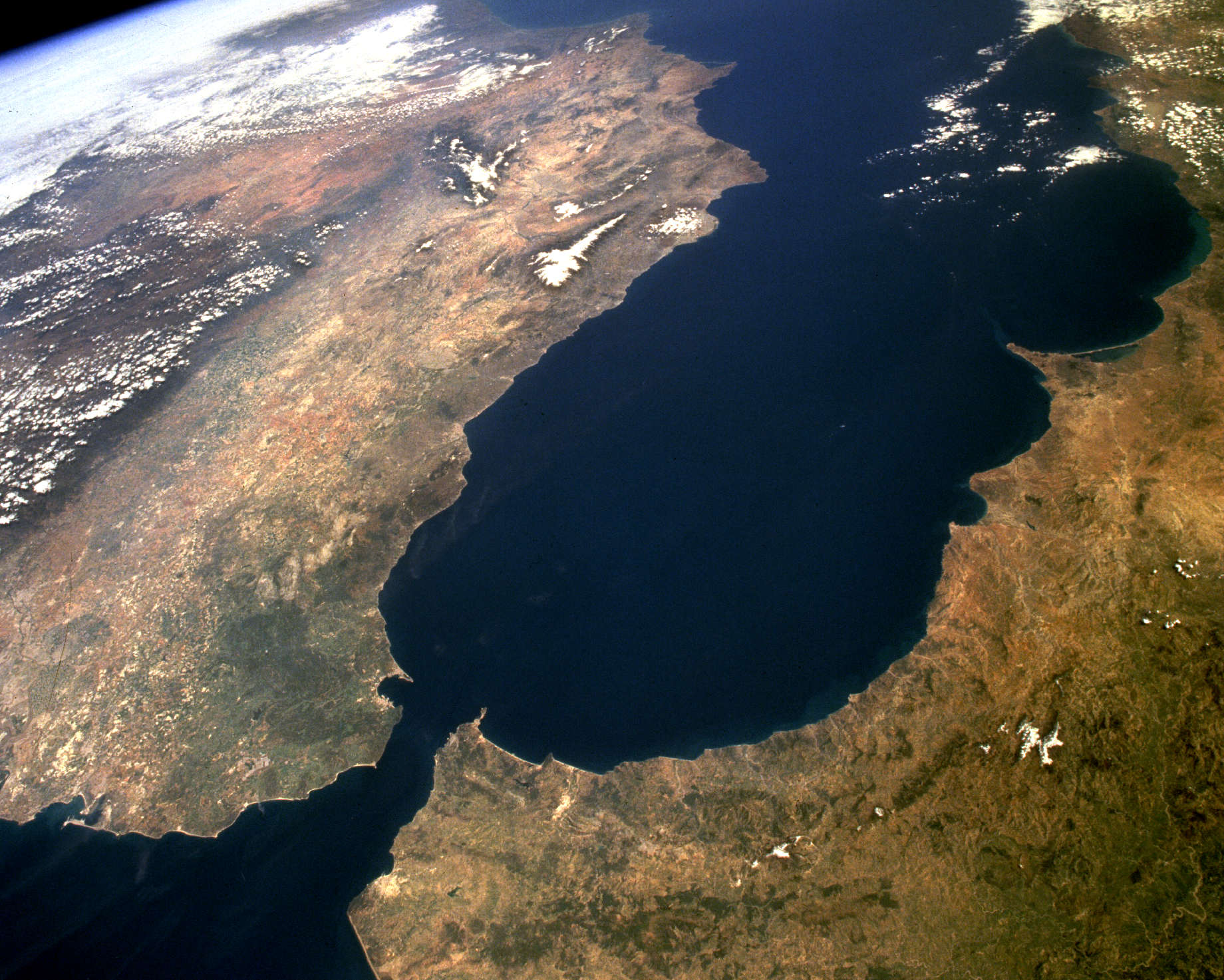
THE
ROCK - View across the Strait of Gibraltar, to Jebel Musa in the background.
GEOLOGY
The seabed of the Strait is composed of synorogenic Betic-Rif clayey flysch covered by Pliocene and/or Quaternary calcareous sediments, sourced from thriving cold water coral communities. Exposed bedrock surfaces, coarse sediments and local sand dunes attest to the strong bottom current conditions at the present time.
Around 5.9 million years ago, the connection between the Mediterranean Sea and the Atlantic Ocean along the Betic and Rifan Corridor was progressively restricted until its total closure, effectively causing the salinity of the Mediterranean to rise periodically within the gypsum and salt deposition range, during what is known as the Messinian salinity crisis. In this water chemistry environment, dissolved mineral concentrations, temperature and stilled
water currents combined and occurred regularly to precipitate many mineral salts in layers on the seabed. The resultant accumulation of various huge salt and mineral deposits about the Mediterranean basin are directly linked to this era. It is believed that this process took a short time, by geological standards, lasting between 500,000 and 600,000 years.
It is estimated that, were the Strait closed even at today's higher sea level, most water in the Mediterranean basin would evaporate within only a thousand years, as it is believed to have done then, and such an event would lay down mineral deposits like the salt deposits now found under the sea floor all over the Mediterranean.
After a lengthy period of restricted intermittent or no water exchange between the Atlantic Ocean and Mediterranean basin, approximately 5.33 million years ago, the Atlantic-Mediterranean connection was completely reestablished through the Strait of Gibraltar by the Zanclean flood, and has remained open ever since. The erosion produced by the incoming waters seems to be the main cause for the present depth of the Strait (900 m (3,000 ft; 490 fathoms) at the narrows, 280 m (920 ft; 150 fathoms) at the Camarinal Sill). The Strait is expected to close again as the African Plate moves northward relative to the Eurasian Plate, but on geological rather than human timescales.
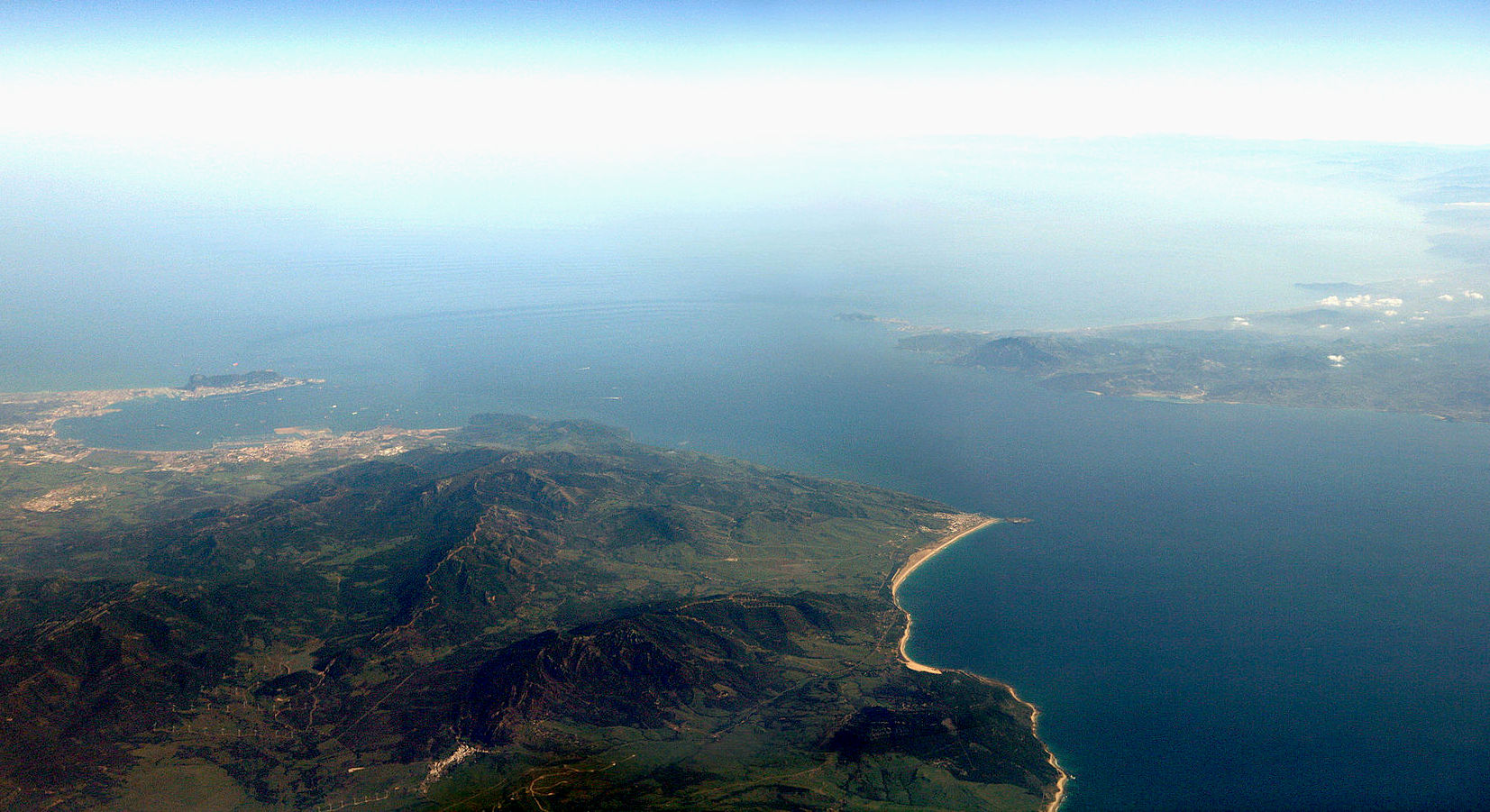
Aerial
view of the Strait of Gibraltar, where you can envisage the Pillars of
Hercules as the two outcrops distinct from the land masses of Spain and
Morocco.
HISTORY
Evidence of the first human habitation of the area by Neanderthals dates back to 125,000 years ago. It is believed that the Rock of Gibraltar may have been one of the last outposts of Neanderthal habitation in the world, with evidence of their presence there dating to as recently as 24,000 years ago. Archaeological evidence of
Homo sapiens habitation of the area dates back c. 40,000 years.
The relatively short distance between the two shores has served as a quick crossing point for various groups and civilizations throughout history, including Carthaginians campaigning against Rome, Romans travelling between the provinces of Hispania and Mauritania, Vandals raiding south from Germania through Western Rome and into North Africa in the 5th century, Moors and Berbers in the 8th–11th centuries, and Spain and Portugal in the 16th century.
Beginning in 1492, the Strait began to play a certain cultural role in acting as a barrier against cross-channel conquest and the flow of culture and language that would naturally follow such a conquest. In that year, the last Muslim government north of the Strait was overthrown by a Spanish force. Since that time, the Strait has come to foster the development of two very distinct and varied cultures on either side of it after sharing much the same culture for over 500 years from the 8th century to the early 13th century.
On the northern side, Christian-European culture has remained dominant since the expulsion of the last Muslim kingdom in 1492, along with the Romance Spanish language, while on the southern side, Muslim-Arabic/Mediterranean has been dominant since the spread of Islam into North Africa in the 700s, along with the Arabic language. For the last 500 years, religious and cultural intolerance, more than the small travel barrier that the Strait presents, has come to act as a powerful enforcing agent of the cultural separation that exists between these two groups.
The small British enclave of the city of Gibraltar presents a third cultural group found in the Strait. This enclave was first established in 1704 and has since been used by Britain to act as a surety for control of the sea lanes into and out of the Mediterranean.
Following the Spanish coup of July 1936 the Spanish Republican Navy tried to blockade the Strait of Gibraltar to hamper the transport of Army of Africa troops from Spanish Morocco to Peninsular Spain. On 5 August 1936 the so-called Convoy de la victoria was able to bring at least 2,500 men across the Strait, breaking the republican blockade.
3D
relief of Estrecho de Gibraltar - Pillars of Hercules
BIODIVERSITY
The Strait has been identified as an Important Bird Area by BirdLife International because of the hundreds of thousands of seabirds which use it every year to migrate between the Mediterranean and the Atlantic, including significant numbers of Scopoli's and Balearic shearwaters, Audouin's and lesser black-backed gulls, razorbills, and Atlantic puffins.
A resident orca pod of some 36 individuals lives around the Strait, one of the few that are left in Western European waters. The pod may be facing extinction in the coming decades due to long term effects of
PCB
pollution.
TIDAL INFLOW AND OUTFLOW
Water flows through the Strait more or less continuously eastwards and westwards. A smaller amount of deeper saltier and therefore denser waters continually work their way westwards the Mediterranean outflow, while a larger amount of surface waters with lower salinity and density continually work their way eastwards the Mediterranean inflow. These general flow tendencies may be occasionally interrupted for brief periods by temporary tidal flows, depending on various lunar and solar alignments. Still, on the whole and over time, the balance of the water flow is eastwards, due to an evaporation rate within the Mediterranean basin higher than the combined inflow of all the rivers that empty into it. At the Strait's far western end is the Camarinal Sill, the Strait's shallowest point which limits mixing between the cold, less saline Atlantic
water and the warm Mediterranean waters.
The Mediterranean waters are so much saltier than the Atlantic waters that they sink below the constantly incoming water and form a highly saline (thermohaline, both warm and salty) layer of bottom water. This layer of bottom-water constantly works its way out into the Atlantic as the Mediterranean outflow. On the Atlantic side of the Strait, a density boundary separates the Mediterranean outflow waters from the rest at about 100 m (330 ft; 55 fathoms) depth. These waters flow out and down the continental slope, losing salinity, until they begin to mix and equilibrate more rapidly, much farther out at a depth of about 1,000 m (3,300 ft; 550 fathoms). The Mediterranean outflow water layer can be traced for thousands of kilometres west of the Strait, before completely losing its identity.
During the Second World
War, German U-boats used the currents to pass into the Mediterranean Sea without detection, by maintaining silence with engines off. From September 1941 to May 1944 Germany managed to send 62 U-boats into the Mediterranean. All these boats had to navigate the British-controlled Strait of Gibraltar where nine U-boats were sunk while attempting passage and 10 more had to break off their run due to damage. No U-boats ever made it back into the Atlantic and all were either sunk in battle or scuttled by their own crews.
Internal waves (waves at the density boundary layer) are often produced by the Strait. Like traffic merging on a highway, the water flow is constricted in both directions because it must pass over the Camarinal Sill. When large tidal flows enter the Strait and the high tide relaxes, internal waves are generated at the Camarinal Sill and proceed eastwards. Even though the waves may occur down to great depths, occasionally the waves are almost imperceptible at the surface, at other times they can be seen clearly in satellite imagery. These internal waves continue to flow eastward and to refract around coastal features. They can sometimes be traced for as much as 100 km (62 mi; 54 nmi), and sometimes create interference patterns with refracted waves.
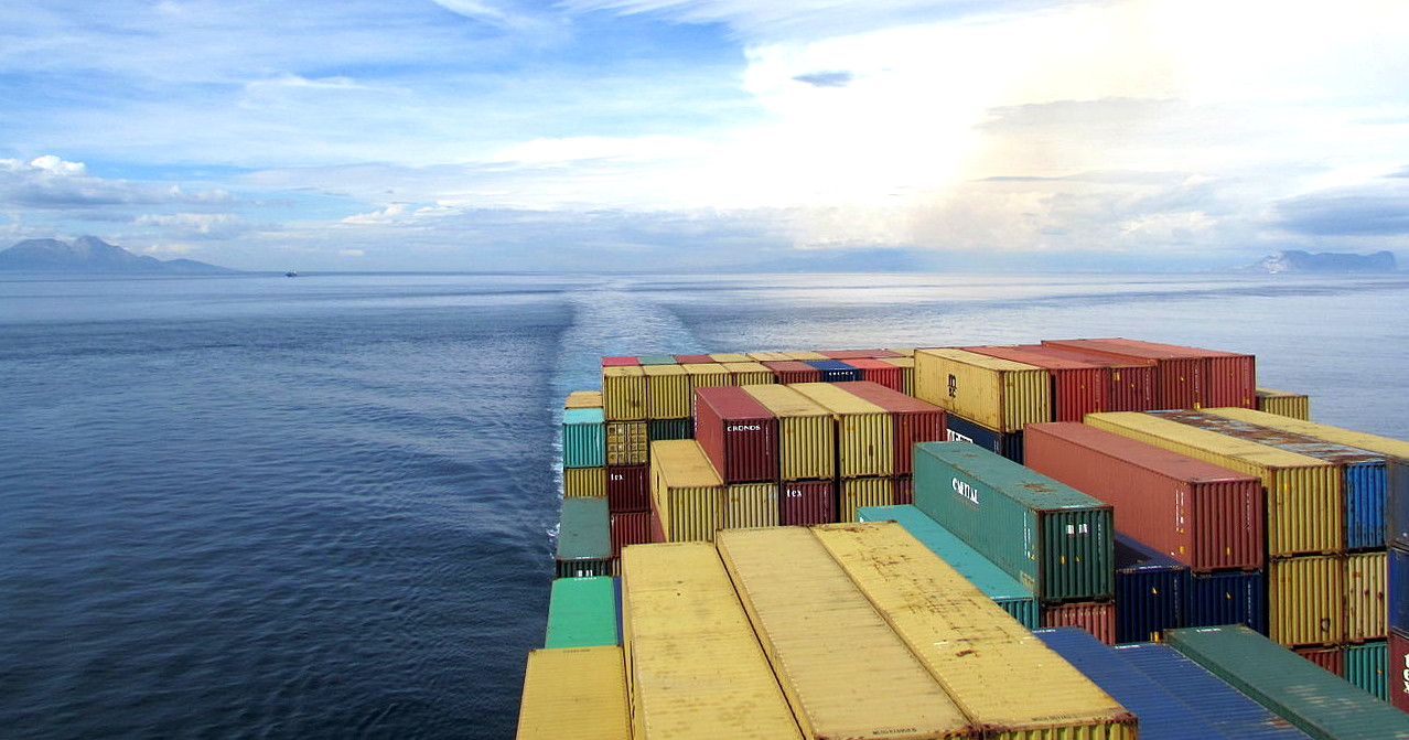
A
container ship heading into the Atlantic from the Mediterranean.
TERRITORIAL WATERS
Except for its far eastern end, the Strait lies within the territorial waters of Spain and Morocco. The United Kingdom claims 3 nautical miles (5.6 km; 3.5 mi) around Gibraltar on the northern side of the Strait, putting part of it inside British territorial waters. As this is less than the 12 nautical miles (22 km; 14 mi) maximum, it means, according to the British claim, that part of the Strait lies in international waters. The ownership of Gibraltar and its territorial waters is disputed by Spain. Similarly, Morocco disputes Spanish sovereignty over Ceuta on the southern coast. There are several islets, such as the disputed Isla Perejil, that are claimed by both Morocco and Spain.
Under the United Nations
Convention on the Law of the
Sea, vessels passing through the strait do so under the regime of transit passage, rather than the more limited innocent passage allowed in most territorial waters. Therefore, a vessel or aircraft has the freedom of
navigation or overflight for the purpose of crossing the strait of Gibraltar.
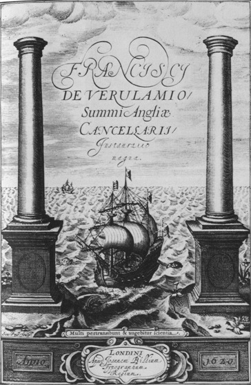
Francis Bacon: Instauratio Magna 1620
SPARTEL
Spartel Bank or Majuán Bank is a submerged former island located in the Strait of Gibraltar near Cape Spartel and the Spartel Sill. Its highest point is currently 56 metres (184 ft) below the surface. Spartel Bank is one of several seamounts in the bed of Gibraltar Strait; similar but deeper seamounts are found at Camarinal Sill and further east. These represent landslide blocks which slid south from the north bank of the Strait of Gibraltar when the strait was formed, possibly through erosion by inflowing waters of the Zanclean flood.
It vanished under the surface approximately 12,000 years ago due to rising ocean levels from melting ice caps after the last Glacial Maximum. It has been proposed by researchers Jacques Collina-Girard and Marc-André Gutscher as a site for the legendary lost island of Atlantis. In follow-up correspondence, however, Gutscher indicated that the island could not have been Atlantis, referring to Plato's description of a Bronze Age society, which Spartel could not have supported at the time. A detailed review in the Bryn Mawr Classical Review comments on the discrepancies in Collina-Girard's dates and use of coincidences, concluding that he "has certainly succeeded in throwing some light upon some momentous developments in human prehistory in the area west of Gibraltar. Just as certainly, however, he has not found Plato's Atlantis."
https://www.
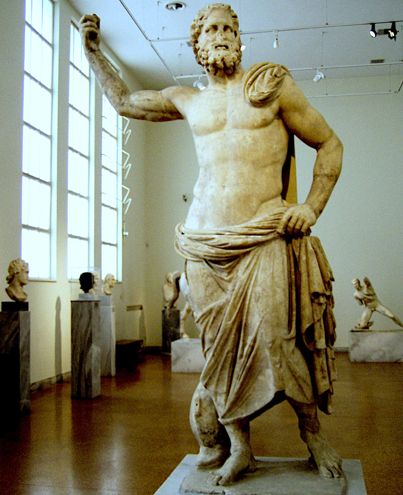
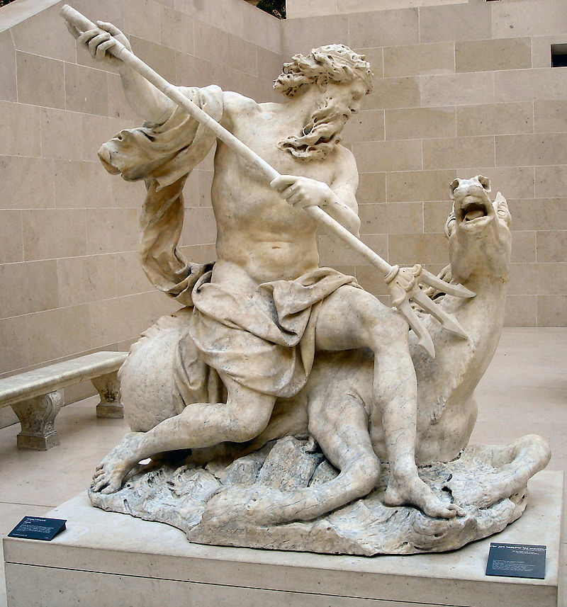
POSEIDON
AND NEPTUNE
|